Mapping Ancient Africa Quaternary International Special Issue #10
Kinyanjui, R. N., Mashaka, H. K., Chritz, K. L., Wemanya, S. N., Ndiema, E. K., Braun, D. R., & Bamford, M. (2026). Holocene vegetation dynamics of the Koobi Fora Basin, East Turkana, Kenya: Insights from phytolith analysis. Quaternary International, 759, 110131. https://doi.org/10.1016/j.quaint.2026.110131
To find the complete list of articles in the Mapping Ancient Africa special issue of Quaternary International click here.
Gosling, W. D., de Wolf, I. K., Witteveen, N. H., de Zwaan, S. B., Van Teulingen, C., Föllmi, D., Thissen, W., Vink, V. B., Woutersen, A., Philip, A. L., van Herk, M. J., Nascimento, M. N., Prins, M. A., & McMichael, C. N. H. (2025). Herbivory and vegetation openness in a pre-farming European landscape. Plant Ecology & Diversity, 1–22. https://doi.org/10.1080/17550874.2025.2576566
This manuscript has been developed over many years through the contributions of many MSc and BSc students based at the University of Amsterdam.
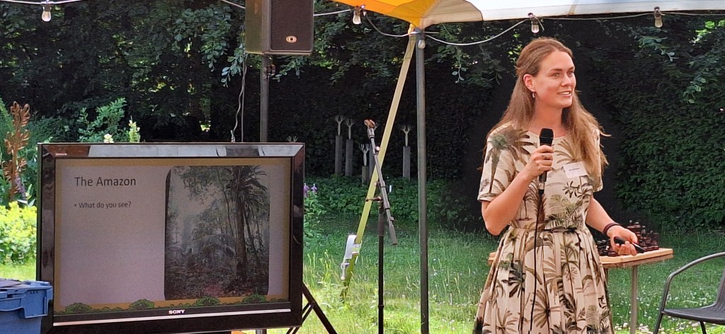
Ecology of the Past blog contributor Nina Witteveen was awarded the Hugo de Vries prize on 13 June 2025 at the Botanic Gardens in Nijmegen. The Hugo de Vries prize is awarded by the KNbv (Royal Dutch Botanical Society) and the Stichting Hugo de Vries fonds (Hugo de Vries foundation) for the best PhD thesis in Botany defended at a Dutch University. This years prize was awarded to Nina for her thesis“Long-term Forest Recovery in Amazonia: Insights from Phytolith Analysis” (University of Amsterdam) which was completed under the supervision of Crystal McMichael.
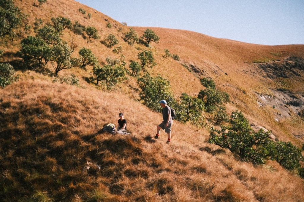
As part of my MSc Biological Sciences research project at the University of Amsterdam I travelled to Africa, where I first presented the early findings of my research at the SASQUA congress (blog post 1) in Oudtshoorn (Western cape), before heading to the University of Kwa-Zulu Natal (blog post 2). Here I met up with local experts and prepared for the upcoming fieldwork, which the previous parts of this blog series covered. Now, the time has come for the final and best part, about my fieldwork in the absolutely gorgeous Drakensberg mountains.
Aims: As the samples for my research had already been collected earlier by my supervisors Prof. Dr. Jemma Finch & Prof. Dr. Trevor Hill for the University of Kwa-Zulu Natal, our initial goal was to collect various samples (charcoal, sediment cores, etc) for the next students. During my time at the university of Kwa-Zulu natal, however, we realized that it would be great to collect a bunch of C3 and C4 grass species, to extract phytoliths (amorphous silica particles formed in plant tissues) from, which would help with the interpretation of our data. This then became our new focus. To achieve this goal we visited the Drakensberg twice, one day trip in the weekend, and one trip with an overnight stay.
Day 1
After a night of utterly terrible sleep (I was alone on the AirBnB property, the gate did not lock due to the cold, and our dogs started barking at something (someone!?) at 2AM), I woke up at 6AM to get ready for the long day ahead of us. Jemma came to pick me up at the, bringing coffee with her, which I really appreciated. We then picked up Trevor at their place and began our drive towards the mountains. I had not seen much of the landscape in the Kwa-Zulu Natal province, which turned out to be very compared to the Western Cape. Whereas the western cape had fynbos vegetation (very similar to the Mediterranean, KZN was more savanna like. There was grass everywhere the eye could see, except for the patches of spruce, planted by humans. Halfway through the drive the Drakensberg mountains came into view, which was stunning. We then drove through some small villages, until we finally arrived at the Berg.
The aim of this thesis was to provide insight into past human activities in Amazonia, and the long-term forest recovery that followed, using phytolith analysis. The first part of this thesis focused on improving phytolith analysis as a proxy for vegetation changes in Amazonia. The morphological variation of 24 Amazonian palm phytoliths were assessed (Chapter 2) to improve the taxonomic resolution of palm phytolith identification, and results indicate the potential to differentiate Euterpe, Bactris, Oenocarpus, Attalea, Iriartea deltoidea, and Socratea exorrhiza. Chapter 3 demonstrated that phytolith assemblages (from terrestrial soil cores) varied across a gradient of (modern) human disturbance in Surinamese rainforests. In Chapters 4-6, we developed beta regression and GLM models to predict forest cover and biomass changes within 200 m and 1 km of Amazonian lakes, respectively, using grass phytoliths. Applying these innovations in Chapters 5-6 demonstrated that past human activities were on localized scales in Suriname and temporally heterogenous in Ecuador. Palm enrichment of Attalea, Oenocarpus and Astrocaryum occurred within 0 km, 1 km, and 8 km of an archaeological site in Suriname (Chapter 5). In Ecuador, forest cover and biomass ranged between 48-84% and 77-247 Mg/ha, respectively, and the largest decreases (between 1000-1255 CE) were paired with fires (Chapter 6). Overall, the type, intensity, timing, and frequency of disturbances are important factors influencing long-term forest recovery and ecological legacies in Amazonia.
Witteveen, N.H., Kleijwegt, Z.S., Geara, H., Kool, C., Blaus, A., Saenz, L.C., Gomes, B.T., Philip, A., Bush, M.B. & McMichael, C.N.H. (2024) Quantifying past forest cover and biomass changes in the Ecuadorian Amazon. New Phytologist. DOI: 10.1111/nph.20237
This paper is the latest to come from the PhD thesis of Nina Witteveen who defended at the University of Amsterdam earlier in 2024. To find out more about Nina’s PhD click here.
After visiting the SASQUA conference and presenting my work there (see SASQUA Conference post), we travelled to the University of Kwa-Zulu Natal in Pietermaritzburg (UKZN), where I would be staying for three weeks. During this period, my goal was to meet with local experts and to visit my site of study in the Drakensberg mountains. This would help me gain more insight into the environment I’m studying and provide me with an opportunity to collect more samples.
Pietermaritzburg
After the SASQUA congress finished, we flew from Port-Elisabeth to Durban. This would be my first time in one of the highly urbanised parts of South-Africa. We drove about an hour from Durban to Pietermaritzburg, better known locally as PMB, and I immediately noticed the stark difference between the countryside of the Western cape and the urbanised areas of Kwa-Zulu Natal. The city was rough around the edges and felt generally less safe than the laid-back countryside. Luckily, my accommodation was located in one of the better neighbourhoods close to campus. Macho the adorable dog of the AirBnB owners further assured my feeling of safety.
Heijink, B.M., Zwarts, A., Witteveen, N.H., Watson, J., Ebbenhorst, A., Veenman, F., Kessel, M., León-Yánez, S., Guevara-Andino, J., Endara, M., Rivas-Torres, G., Bush, M.B. & McMichael, C.N.H. (2024) Past fire and vegetation change in the hyperdiverse forests of the Ecuadorian Amazon. Plants 13. DOI: 10.3390/plants13152048
In this article I summarize and describe the scientific research that was performed near Botopasi in Suriname, which was published in Ecology as ‘Pre-contact and post-colonial ecological legacies shape Surinamese rainforests’ (https://doi.org/10.1002/ecy.4272).
Figure 1: Our research team in the field
Background
In October 2021, between COVID-19 restrictions, I joined archaeologist dr. Cheryl White and her team to excavate the remnants of a ‘lost village’ of Saamaka Maroons in the Surinamese rainforest. Maroons are the descendants of enslaved Africans, who, in the late 1600s, fled plantations to live in freedom in the Surinamese rainforests. Dr. White has been investigating the first villages and the movements of Suriname’s Maroon communities for decades and is an expert in this topic.
Our wonderful research team consisted of Farisha Kartosemito B.Sc., Sushmeeta Ganesh B.Sc., Jõvan Samson B.Sc., Agir Axwijk B.Sc., Santosh Singh M.A., Thanya Fonkel MPA, Harrold Sijlbing, Dombi Lö, Gerno Eduards & Farik Eduards. We were welcomed in the village Botopasi, and after a day of hard work in the field, we enjoyed delicious Surinamese food and played troefcall!
As an ecologist, I was interested in the ecological effects of past human activities on the forest ecosystem. In these rainforests, Maroon and Indigenous communities often burn and remove trees near their homes to grow a variety of crops like cassava, tayer, maize and banana. After some years, the cultivation site is abandoned and forests can grow back. But do those forests recover back to their original state?
What did the forest look like before people arrived and settled in the landscape of Boven Suriname?
To study how Maroon communities have shaped Surinamese forests over time, I made a reconstruction of the landscape of the past (going back thousands of years). The landscape was near an archaeological sites called ‘Beng Tau’, where Maroons lived in the 17th century. We used plant fossils and charcoal remains to reconstruct the forest from the past, to research if people were using fire and growing crops, and how the forests recovered from that.
Results and implications
Figure 2: Phytoliths from the banana plant
The charcoal remains and plant fossils, particularly from maize and banana, confirmed Saamaka Maroons settled in the area since ca. 1700 and practiced slash-and-burn agriculture was near the archaeological site called ‘Beng Tapu’ (Figure 2). The site may have been a cooking area, because remnants of pottery with maize, rice and banana were found. Within 1 km of Beng Tapu, we found large fragments of charcoal, and plant fossils from maize and banana. Smaller charcoal fragments and banana were found within 5 km of the archaeological site. Nowadays, agriculture is practiced within 8 km of the archaeological site and Suriname river. The area used for agriculture likely expanded over time.
How did the forest recover from these activities?
Within 1 km of the archaeological site, forests were burnt and used multiple times. Here, forests have a lower biomass than further away from Beng Tapu, meaning fewer or smaller trees have grown back. Also, Attalea and Oenocarpus palm trees increased. Still today, the Saamaka Maroon community uses the maripa palm to make oil. Therefore, the number of maripa palms may have increased due to human activities like cooking and oil production! Attalea and Oenocarpus palms are also adapted to open conditions and fire, showing the influence people had on the environment and how the forest responded to fires.
Further (2-7 km) away from the archaeological site, where disturbances were fewer, the forests recovered much better but Astrocaryum palms grew back in higher numbers in the understory of the forests. What makes these palms so resilient? We are still uncertain. The forests furthest away (>8km) from Beng Tapu showed little signs of disturbances.
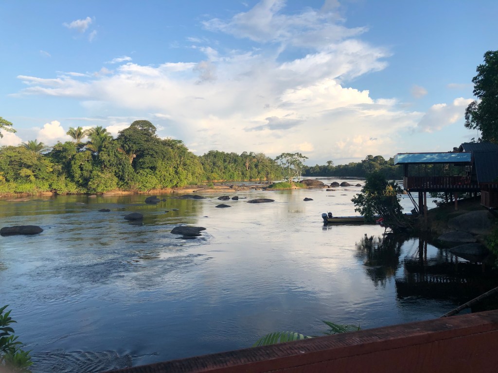
Figure 3: View from the Suriname River
A long human history, and an Indigenous archaeological site?
The Saamaka Maroons were not the first people to have inhabited the forests near Botopasi. Charcoal fragments show that people were in region (the ca. 20 km radius we studied) already 2000 years ago, and fire events occurred ca. 2000, 1700,1500, 1300, 1200 and 800 years ago. We don’t know which Indigenous Cultures may have inhabited this region, because of limited archaeological and historical research here. Large charcoal fragments were found ca. 7 km away from Beng Tapu, across the Suriname River. Could this be an Indigenous archaeological site?
Conclusion
Our results show the timing, intensity and frequency of past disturbances are very important for good forest recovery and some disturbances from the past can still impact the modern vegetation.
Unravelling the past not only tells us about the ancestors of Maroons and the lives of Indigenous communities before the 1500s. The past also helps us to understand how forests respond to human impacts. To better guide conservation strategies, we need to do more archaeological and ecological research in Surinamese rainforests.
Next to the Suriname River, past human activities shaped the forest andincreased local palm abundances. The broader forested region showed a healthy recovery. These results indicate that the Saamaka Maroon community preserved most of the forests they inhabited since the 1700s. We can learn from traditional knowledge about which management practices are sustainable to keep forests healthy.
If you want to know more about the “hows” of this research…dive with me into the methodology!