13.00-13.30: Ontvangst met koffie / Arrival with coffee
13.30-14.00: Harm Smeenge & Ariet Kieskamp (Bosgroepen): Landscape ecological/historical ecological characteristics of bogs in the eastern slopes of the Veluwe
14.00-14.30: Roy van Beek (WUR): Archeological, archeobotanical and morphological aspects of the Celtic Field complex of Vaassen (Veluwe)
14.30-15.00: Koffiepauze / Coffee break
15.00-15.30 Jasper Candel (WUR): Geophysical research in the push moraine of the Veluwe and relation with peat development in valley mires
15.30-16.00: William Gosling (UvA): On the use of spores of coprophilous fungi in characterizing herbivory past and present in Dutch landscapes
Voor mensen die slecht ter been zijn, is er beperkte mogelijkheid om met eigen auto deel te nemen aan de excursie (max. 2 auto’s kunnen parkeren bij de excursiepunten). / For people with walking or cycling difficulties there is a limited opportunity to come in a car on the trip (maximum 2 cars can park at the excursion points).
For further information and costs please email Nelleke van Asch (secretary of the Palynologische Kring). Contact details can be found at: https://www.palynologischekring.nl/contact/
During the Mapping Ancient Africa writing workshop in Kenya (3-6 June 2024) Stefanie Kaboth-Bahr conducted a series of short interviews with the scientists attending. Below you can find part 2 (of 2) of the interviews with the participants in the workshop. Watch the videos to find out their scientific stories and top tips for academic writing. Watch all the Mapping Ancient Africa videos on the Mapping Ancient Africa YouTube Playlist.
The participants (part 2 of 2)
Ruth Kiely (University of Amsterdam, Netherlands)
Husna Mashaka (Arizona State University, USA & National Museums of Kenya, Kenya)
During the Mapping Ancient Africa writing workshop in Kenya (3-6 June 2024) Stefanie Kaboth-Bahr conducted a series of short interviews with the scientists attending. During the interviews she asked the participants and instructors to describe their scientific background, what had motivated them to take part in the writing workshop, and what they thought the most important thing they had gained from it. You can now meet the first four of these scientists now by watching the videos below, or catch up with all the latest videos on the Mapping Ancient Africa YouTube Playlist.
The participants (part 1 of 2)
Olugbenga Boboye (University of Ibadan, Nigeria)
Angela Effiom (University of the Witwatersrand, South Africa)
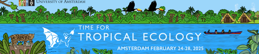
The European Conference of Tropical Ecology will take place in Amsterdam between 24 and 28 February 2025. The call for session ideas is currently open (deadline 19 August). So please visit the conference web pages to find out more and submit your idea that will help shape the program and make this conference a success.
To find out how to submit your session idea click here.
Bremond, L., Aleman, J.C., Favier, C., Blarquez, O., Colombaroli, D., Connor, S.E., Cordova, C.E., Courtney-Mustaphi, C., Dabengwa, A.N., Gil-Romera, G., Gosling, W.D., Hamilton, T., Montade, V., Razafimanantsoa, A.H.I., Power, M.J., Razanatsoa, E., Yabi, I. & Vannière, B. (2024) Past fire dynamics in sub-Saharan Africa during the last 25,000 years: Climate change and increasing human impacts. Quaternary International.DOI: 10.1016/j.quaint.2024.07.012
Heijink, B.M., Zwarts, A., Witteveen, N.H., Watson, J., Ebbenhorst, A., Veenman, F., Kessel, M., León-Yánez, S., Guevara-Andino, J., Endara, M., Rivas-Torres, G., Bush, M.B. & McMichael, C.N.H. (2024) Past fire and vegetation change in the hyperdiverse forests of the Ecuadorian Amazon. Plants 13. DOI: 10.3390/plants13152048
On the 25 July 2024 the 19th Mapping Ancient Africa (MAA) seminar, entitled Climate frameworks for the Middle Stone Age and Later Stone Age in Northwest Africa, was delivered by Solène Boisard (University Montreal). In the seminar Solène presented two lines of evidence for past climate change in north-western Africa over the last c. 70,000 years. One from mechanistic climate models (via the PastClim package, for more details see: Leonardi et al. 2023) and one from reconstructions based on archaeological evidence. She found good agreement between the two approaches and linked climatic changes to the transition from Middle Stone Age to Late Stone Age technologies.
COLLABORATION OPPORTUNITY: The TIP-TOP project, funded through the Dutch Research Council (NWO) and awarded to Rick Hennekam at the NIOZ Royal Netherlands Institute for Sea Research (NIOZ), is running from 2024-2029 and aims to use sediments accumulated in front of North African rivers to study environmental tipping points in North Africa. Specifically, the project focuses on available sediments from the Nile River delta, a now-dormant river system in Libya, as well as material from in front of the Senegal and Gambia rivers that will be acquired during a cruise early 2025. A multidisciplinary group of scientists is collaborating within this project, including scientists from NIOZ, GFZ Potsdam, ETH Zürich, Wageningen University, and the Utrecht University, using especially (in)organic and palynological proxies. Yet, we are keen to start new collaborations, especially with scientists based in northwest Africa. Potentially we could aim for the INQUA Fellowship Program For International Mobility (deadline 15 of September, 2024) for someone to gain international experience at one of the involved institutes for the duration of 3–6 months. If you are interested to link up with Rick please join the seminar to speak with him, or contact him directly. Note that participation in the 2025 expedition to the coasts of Gambia, Senegal, and Mauritania can be discussed too, but available places are very limited.
This video was recorded after the 19th online Mapping Ancient Africa seminar given by Solène Boisard, to watch her seminar on the past climate of north-western Africa and others in the series click here. To find out more about the Mapping Ancient Africa project click here.
In this article I summarize and describe the scientific research that was performed near Botopasi in Suriname, which was published in Ecology as ‘Pre-contact and post-colonial ecological legacies shape Surinamese rainforests’ (https://doi.org/10.1002/ecy.4272).
Figure 1: Our research team in the field
Background
In October 2021, between COVID-19 restrictions, I joined archaeologist dr. Cheryl White and her team to excavate the remnants of a ‘lost village’ of Saamaka Maroons in the Surinamese rainforest. Maroons are the descendants of enslaved Africans, who, in the late 1600s, fled plantations to live in freedom in the Surinamese rainforests. Dr. White has been investigating the first villages and the movements of Suriname’s Maroon communities for decades and is an expert in this topic.
Our wonderful research team consisted of Farisha Kartosemito B.Sc., Sushmeeta Ganesh B.Sc., Jõvan Samson B.Sc., Agir Axwijk B.Sc., Santosh Singh M.A., Thanya Fonkel MPA, Harrold Sijlbing, Dombi Lö, Gerno Eduards & Farik Eduards. We were welcomed in the village Botopasi, and after a day of hard work in the field, we enjoyed delicious Surinamese food and played troefcall!
As an ecologist, I was interested in the ecological effects of past human activities on the forest ecosystem. In these rainforests, Maroon and Indigenous communities often burn and remove trees near their homes to grow a variety of crops like cassava, tayer, maize and banana. After some years, the cultivation site is abandoned and forests can grow back. But do those forests recover back to their original state?
What did the forest look like before people arrived and settled in the landscape of Boven Suriname?
To study how Maroon communities have shaped Surinamese forests over time, I made a reconstruction of the landscape of the past (going back thousands of years). The landscape was near an archaeological sites called ‘Beng Tau’, where Maroons lived in the 17th century. We used plant fossils and charcoal remains to reconstruct the forest from the past, to research if people were using fire and growing crops, and how the forests recovered from that.
Results and implications
Figure 2: Phytoliths from the banana plant
The charcoal remains and plant fossils, particularly from maize and banana, confirmed Saamaka Maroons settled in the area since ca. 1700 and practiced slash-and-burn agriculture was near the archaeological site called ‘Beng Tapu’ (Figure 2). The site may have been a cooking area, because remnants of pottery with maize, rice and banana were found. Within 1 km of Beng Tapu, we found large fragments of charcoal, and plant fossils from maize and banana. Smaller charcoal fragments and banana were found within 5 km of the archaeological site. Nowadays, agriculture is practiced within 8 km of the archaeological site and Suriname river. The area used for agriculture likely expanded over time.
How did the forest recover from these activities?
Within 1 km of the archaeological site, forests were burnt and used multiple times. Here, forests have a lower biomass than further away from Beng Tapu, meaning fewer or smaller trees have grown back. Also, Attalea and Oenocarpus palm trees increased. Still today, the Saamaka Maroon community uses the maripa palm to make oil. Therefore, the number of maripa palms may have increased due to human activities like cooking and oil production! Attalea and Oenocarpus palms are also adapted to open conditions and fire, showing the influence people had on the environment and how the forest responded to fires.
Further (2-7 km) away from the archaeological site, where disturbances were fewer, the forests recovered much better but Astrocaryum palms grew back in higher numbers in the understory of the forests. What makes these palms so resilient? We are still uncertain. The forests furthest away (>8km) from Beng Tapu showed little signs of disturbances.
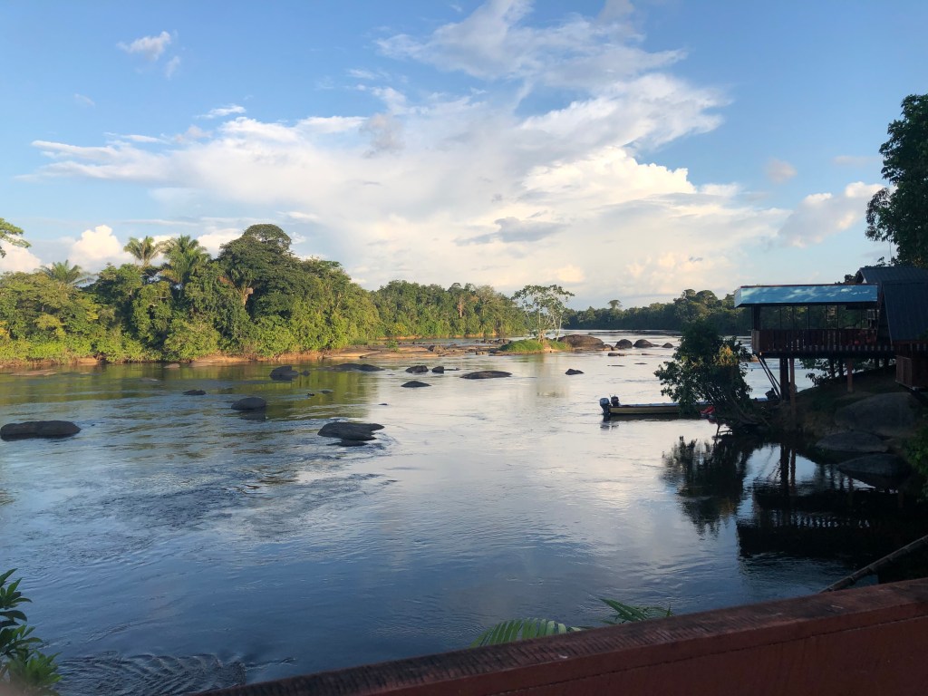
Figure 3: View from the Suriname River
A long human history, and an Indigenous archaeological site?
The Saamaka Maroons were not the first people to have inhabited the forests near Botopasi. Charcoal fragments show that people were in region (the ca. 20 km radius we studied) already 2000 years ago, and fire events occurred ca. 2000, 1700,1500, 1300, 1200 and 800 years ago. We don’t know which Indigenous Cultures may have inhabited this region, because of limited archaeological and historical research here. Large charcoal fragments were found ca. 7 km away from Beng Tapu, across the Suriname River. Could this be an Indigenous archaeological site?
Conclusion
Our results show the timing, intensity and frequency of past disturbances are very important for good forest recovery and some disturbances from the past can still impact the modern vegetation.
Unravelling the past not only tells us about the ancestors of Maroons and the lives of Indigenous communities before the 1500s. The past also helps us to understand how forests respond to human impacts. To better guide conservation strategies, we need to do more archaeological and ecological research in Surinamese rainforests.
Next to the Suriname River, past human activities shaped the forest andincreased local palm abundances. The broader forested region showed a healthy recovery. These results indicate that the Saamaka Maroon community preserved most of the forests they inhabited since the 1700s. We can learn from traditional knowledge about which management practices are sustainable to keep forests healthy.
If you want to know more about the “hows” of this research…dive with me into the methodology!