Reyan Christ graduating with an MSc in Earth Sciences
On the 18 March 2026 I had the fun challenge of speaking at two MSc graduation ceremonies that were running at the same time. Two ‘long-term’ members of the palaeoecology team at the University of Amsterdam had reached the culmination of their degree program.
Reyan Christ graduating Cum laude in MSc Earth Sciences (track Earth System Science) and Jelle Kraak graduating in MSc Biological Sciences (track Ecology & Evolution).
Reyan was up 2nd in the Earth Sciences program, and Jelle was up 5th in Biological Sciences, giving me approximately 10 mins to get between rooms! Thankfully everything ran to time and I was able to deliver my speeches for them both. It was great to meet their friends and families and celebrate this important moment for their education.
Jelle Kraak graduating with an MSc in Biological Sciences
It was also great to celebrate the submission of a manuscript (the day before) on which they are first and second author. This manuscript is based on a combination of their, and other students, theses work on past environmental change in the Drakensberg Mountains (South Africa), and conducted in collaboration with Jemma Finch and Trevor Hill at the University of KwaZulu-Natal. We now cross our fingers that the journal editors and reviewers are as excited as we are about their findings. Fingers crossed we can be announcing the published version on here later in the year…
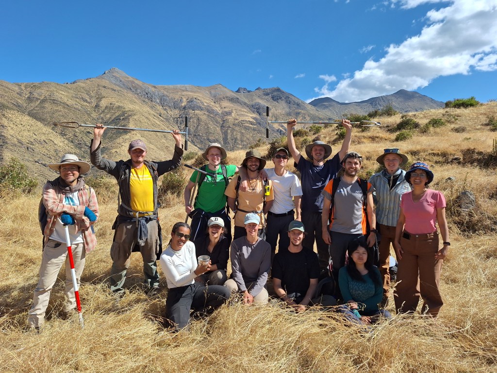
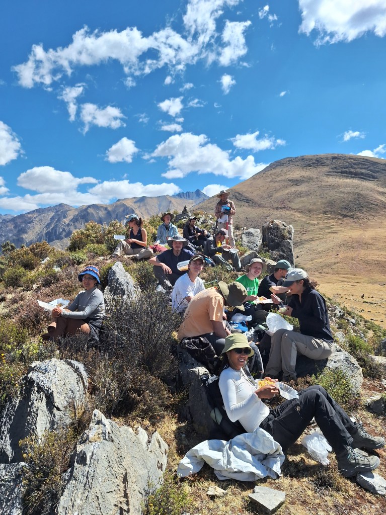
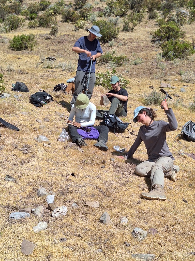
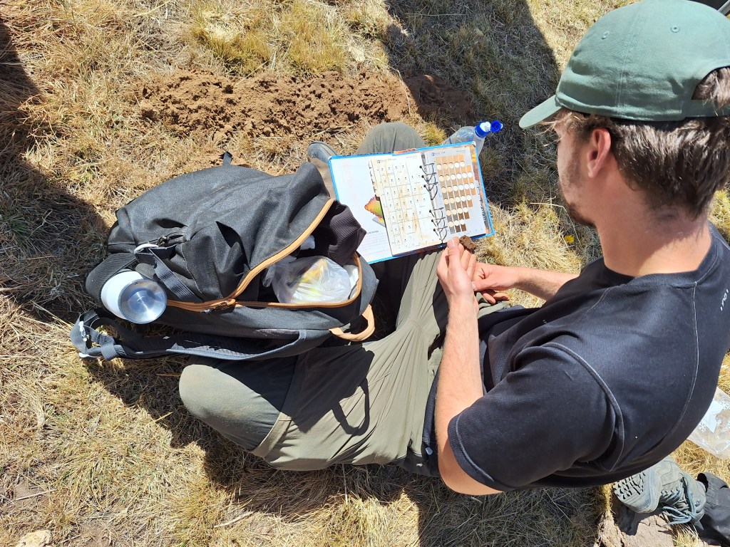
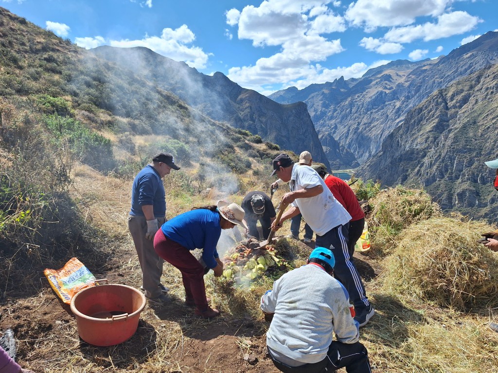
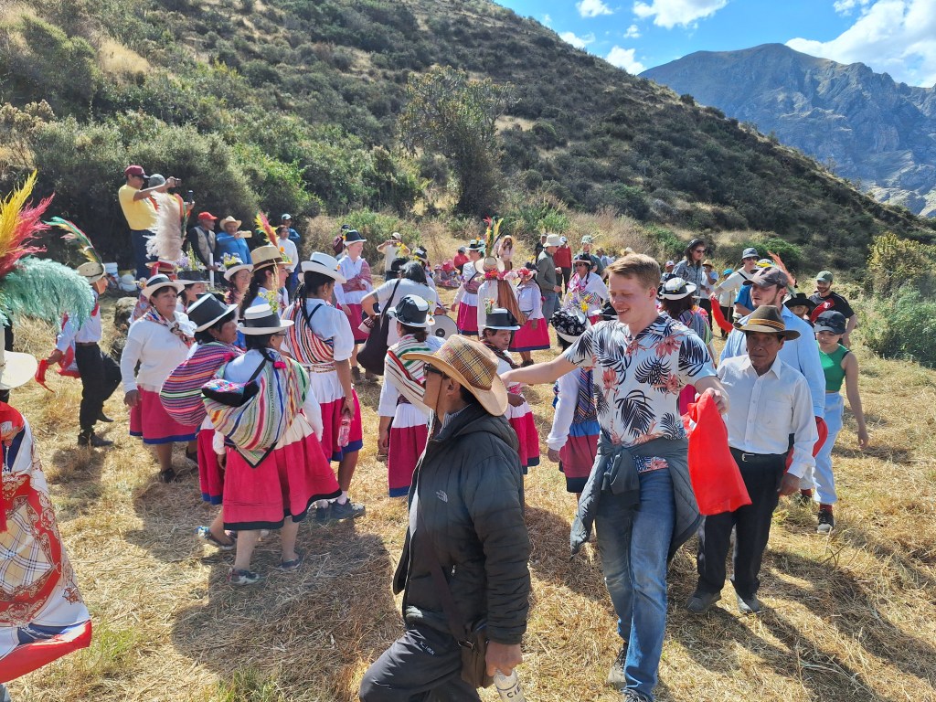
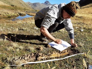
The University of Amsterdam MSc Earth Sciences “Geoecological Systems” field course took place this year in Miraflores (Peruvian Andes) during June and July. Eighteen students, including three from Peruvian institutions, spent four weeks exploring the high Andes. During this time the students developed scientific projects to address interests of the local population related to soil quality, environmental pollution, water resources and cultural heritage. Access to the area and embedding within the community was enabled by The Mountain Institute Peru. During the course the students gained extensive ‘hands on’ field experience, developed teamworking skills and discovered the benefits of a participatory approach to research.
This course runs once every two years (to find out about the 2022 expedition click here). Want to join us on a future expedition? Check out our degree program here to enroll.
Images from the University of Amsterdam Peru field course 2024
The pollen and phytolith identification quiz! Is that an Asteraceae phytolith I see…???
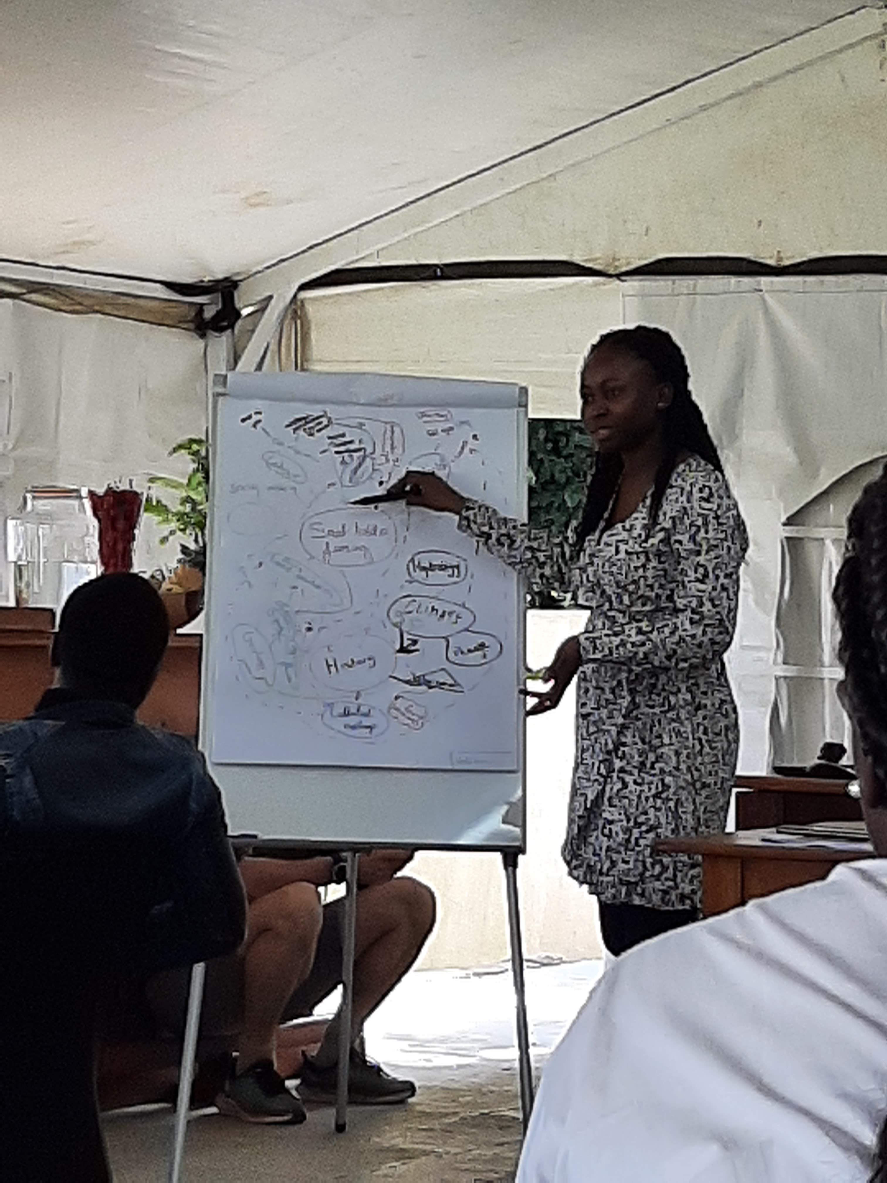
The University of Amsterdam “Palaeoecology” course commenced this week with lectures getting students up to speed with the fundamental principles and approaches to the subject, and laboratory practicals training students in the identification of micro- and macro-fossils. Once students have gained a basic understanding of pollen and phytolith identification – and demonstrated this by passing the ‘dreaded’ identification quiz – it is time to commence the group project work.
This year the students are trying to identify from which study site their ‘mystery slides’ come from on the basis of the micro-fossil assemblages (pollen and phytoliths) that they contain. The study sites all come from the area around Hilversum (Netherlands) and (could) include: heathland, pine forest, mix-deciduous forest, and birch woodlands. In addition, just to make it more interesting, one group has samples taken from the medieval palaeosol that is found locally.
Next week is field work week and the students will then need to parameterise the vegetation around the Hilversum area in such a way that they: (i) get a representative sample the variation across the landscape, and (ii) can compare the vegetation data with their micro-fossil data. Then, following the number crunching in the third week of the course, we will find out if the different groups can identify the correct study site from which there samples came…
The Palaeoecology course at the University of Amsterdam is part of the BSc Biology program, it is also frequently taken by students on the BSc Future Planet Studies degree. We also welcome students from other programs, such as BSc Béta-Gamma, and international exchange students.
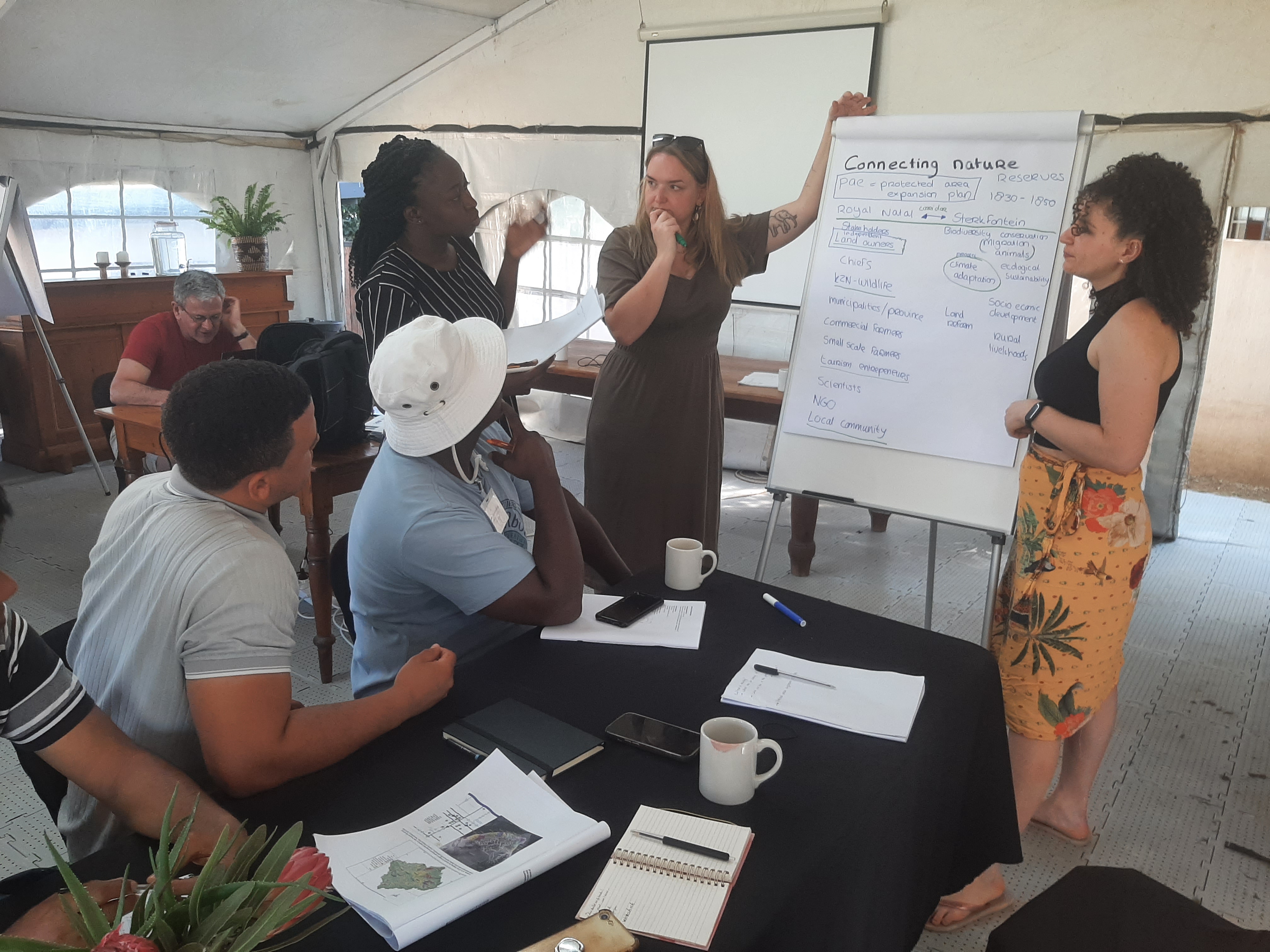
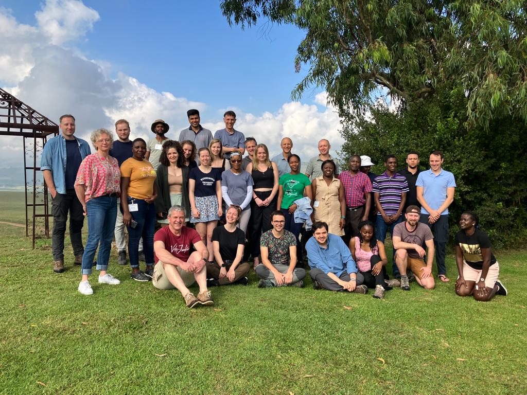
The course “Landscape Dynamics in an era of change: Learning from the past to face the future” took place in the Drakensberg Mountains of South Africa between 5 and 15 March 2023. The course was run by the Graduate School for Production Ecology and Resource Conservation (PERC) and participants were drawn from universities in the Netherlands and South Africa. The main goal of the course was to investigate the past and current dynamics of the region and predict possible futures in an inter- / trans-disciplinary context. Consequently the content of the course was incredibly diverse including: geology, geomorphology, palaeoecology, cultural history, vegetation studies, soil science, farming systems and forestry. These topics were integrated into four group projects centered on invasive species, rewilding, commercial farming and small scale farming.
The “Environmental Management” track of the University of Amsterdam MSc Earth Sciences program is the more applied sister to the Earth System Science track. The Environmental Science track is focused on the solutions to societal challenges that can be gained from the Earth sciences. Drawing on linkages with social sciences you will gain a broad interdisciplinary training covering topics including: urban-ecological development, human-wildlife conflicts, and the climate crisis. During the degree you will work with researcher within the interdisciplinary Institute for Biodiversity & Ecosystem Dynamics (IBED), carry out an independent research project, and an internship at a societal facing organisation.
Energy and Climate Change: Investigate the relationship between climate change and energy systems, and confront the challenges of creating a decarbonised world.
GIS and Remote Sensing in Ecosystem Dynamics: Learn how to use large remotely sensed datasets to gain insights into geological, geomorphological and soil systems.
Integrated Coastal Dune Management: Explore the concept of “Resilience Thinking” in tacking the complex management task of protecting the Dutch coastline and its ecosystems.
Metropol Ecology: Focused on the part of the Earth system where people are, investigate biodiversity and ecosystems in urban systems and mega cities.
Science Based Geo-ecological Management: How can science guide environmental management, address key challenges of supporting society, includes field visit to Oostvardersplassen.
System Innovation and Transition Management: Climate, energy and agricultural systems are all changing discover how understanding their dynamics is important for governance and sustainability.
Environmental management of high Andean ecosystems. During the field school in Peru MSc Earth Science students work with locals and NGOs to improve practices (click here to find out more)
The Environmental Management track can be taken in conjunction with the “Science for Sustainability” minor offered by the Faculty of Science, or other free elective courses to broaden your program.
During the course you will do an internship to get direct experience of working outside academia. Organisations hosting internships in recent years have included:
At the University of Amsterdam the MSc Earth Science is split into two tracks, one of these is entitled: “Earth System Science”. Earth System Science is a research intensive track focused on understanding the fundamentals of abiotic and biotic interactions across the globe and through time. During this degree you will spend around 6 months studying to pick up specialist knowledge and skills, and around 18 months actively developing yourself – in your key areas of interest – through project work.
The taught part of the Earth System Science track includes courses such as:
The Earth System: Learn how to analyse Earth system function across space and through time.
Analysis & Modelling Lab: Develop skills in data handeling, analysis and modeling relevant to Earth science.
Biogeochemical Cycles in the Earth System: Study how the dynamics of carbon and nitrogen link to societal challenges.
Climate Change: Explore the scientific basis for climate change an its implications for the environment and society.
Environments Through Time: Consider and analyse environmental change on timescale relevant to landscapes, societies and climates.
GIS and Remote Sensing in Ecosystem Dynamics: Learn how to use large remotely sensed datasets to gain insights into geological, geomorphological and soil systems.
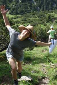
Clare Lee (on one leg, left) during field course in Peru successfully published her literature review which she conducted as part of her MSc in Earth Sciences at the University of Amsterdam.
In addition, free elective courses are possible from across the University of Amsterdam, or at other approved organizations or universities, i.e. it is possible to pick up skills in other specialisms (for example in languages, AI, or programming), or study a course at a university abroad, and have this included within your University of Amsterdam MSc Earth Science degree.
The project part of the Earth System Science track includes two research projects, or one research project and one internship with an external organization (such as a company or NGO). MSc research projects are often closely linked to active research within the Institute for Biodiversity & Ecosystem Dynamics. Some projects and literature reviews conducted by our MSc researchers reach a high enough level to be published in international scientific journals, either on there own or as part of a wider collaboration. Examples of recent papers including MSc researchers (highlighted in bold) are:
Lee, C.M., van Geel, B. & Gosling, W.D. (2022) On the use of spores of coprophilous fungi preserved in sediments to indicate past herbivore presence. Quaternary5, 30. DOI: 10.3390/quat5030030
de Nijs, E.A. & Cammeraat, E.L. (2020) The stability and fate of Soil Organic Carbon during the transport phase of soil erosion. Earth-Science Reviews 201, 103067. DOI: 10.1016/j.earscirev.2019.103067
The MSc Earth Sciences at the University of Amsterdam has a new look for the start of the next academic year (starting September 2023). Drawing on the international research expertise of our staff it is now possible to tailor your studies within two complementary tracks:
Earth System Science: Focused on fundamental aspects of Earth science, such as biogeochemical cycles, climate dynamics, and past environmental change. Our education follows our research in exploring how abiotic and biotic elements of the Earths system interact through time and across the globe.
Environmental Management: Focused on the interface between Earth science and society, key topics include: management of coastal systems, ecosystem dynamics in urban environments, and the relationship between science policy and ethics. During your internship you will have the opportunity to engage with societal partners to develop skills and projects.
For both tracks education is delivered through lectures, field courses, laboratory practical’s, and data analysis. Furthermore, you will get the chance to develop your own research agenda by conducting a project with one of our scientists, or at an external partner or university. In addition to expert knowledge our graduates have transferable skills in data handeling, numerical analysis, and science communication.
To find out more about our program visit click here to visit the MSc Earth Sciences pages on the University of Amsterdam web site.
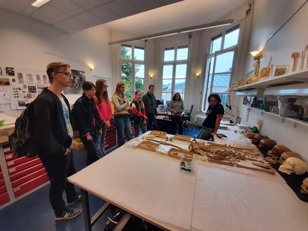
As part of this years BSc Palaeoecology course at the University of Amsterdam we visited the Department of Archaeology. Organised by Anja Fischer we visited the human bone collection, the animal bone collection and the archaeobotany section. Amazing collections and lots of opportunities for cross faculty projects and teaching.
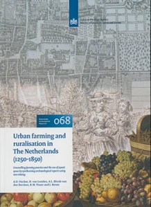
In addition to explaining the physical reference collections Anja also explained how she has been developing data mining techniques to allow information to be synthesised from the thousands of archaeological reports across the Netherlands.
She used this approach to make new discoveries about the role of urban farming and ruralisation in Dutch history. Her findings formed a report for the Dutch national heritage organisation (Rijksdienst voor het Cultureel Erfgoed) which can be downloaded for free (in English).
Fischer, A., van Londen, H., Blonk, A., Visser, R.M. & Renes, J. (2021) Urban Farming and Ruralisation in The Netherlands (1250-1850): Unravelling farming practice and the use of (open) space by synthesising archaeological reports using text mining. Nederlandse Archeologische Rapporten 68. Download free here.
Week 1 (last week) we got everyone up to speed with the fundamentals of palaeoecology (including: key principles, depositional environments, dating methods) and laboratory skills (pollen, phytolith and macrofossil identification). This week (week 2) we are out and about (coring sediments, surveying vegetation and visiting the archaeology department). By the end of the week the students will (should!?) have generated sufficient data in the laboratory and field to be able to identify the location from which their mini-project “mystery slides” were taken. Next week (week 3) will be number crunching to generate the statistical support for their ideas and inferences.
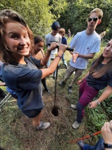
Students collecting sediments using a Russian corer at Langenboom (September, 2022). These samples were recovered in collaboration with the BosGroep Zuid Nederland as part of an ongoing project to gain new insights into the nature of the past landscape in the Netherlands and aid conservation efforts.
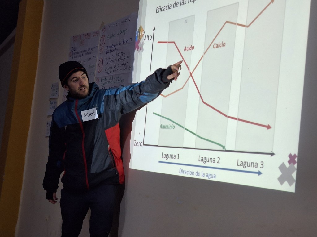
The Science in Archaeology 2 course, run as part of the minor in “Archaeology Today” by the Amsterdam Centre for Ancient Studies and Archaeology (ACASA), is currently underway. This year I have again contributed to this course with a weeks worth of activity related to detecting past human impacts. During this week we have focused on what sorts of evidence contained within the sedimentary record can be used to track human actions. We focused in particular on the manipulation of fire regimes and the the abundance of animals in landscapes (i.e. extinctions vs. introductions of domestic species). To illustrate how past human activities can be detected in landscapes I tapped into some recent publications I have been involved with (eastern Andean flank, Samoa and Mauritius) and the students selected papers in line with their own focus to discuss. Here is what they came up with…