The third Mapping Ancient Africa (MAA) workshop took place in South Africa during March 2026. This workshop was supported by the International Union for Quaternary Research as part of the MAA multi-year project. The aim of this work shop was to provide specialist training in developing research projects and writing of scientific articles. During the workshop each participant developed, and progressed, their own personal work plan. These personal programs allowed the training to be tailored to the participants needs. They included a wide range of challenged ranging from the development of project ideas through to dealing with reviewer comments on manuscripts, and inclusivity, equality and diversity issues.
In addition to the academic program, social activities and excursions were designed to help build academic networks and promote informal discussion of past environmental change issues. These included hikes to the Holley Shelter archaeological site (Bader & Conrad, 2023) and Game Pass shelter rock art site (Hoerle, 2005).
In September to October 2024, I (Rebecca Lellau, PhD at MPI GEA Jena, Germany) had the pleasure to join the three-week palaeocological field expedition to Curaçao as part of the Curaçao Cultural Landscape Project (CCLP)*. This international project consists of the Max Planck Institute of Geoanthropology from Germany, the National Archaeological Anthropological Memory Management (NAAM) Foundation from Curaçao, the Simon Fraser University from Canada, the University of Queensland from Australia, and the QLC inc. / InTerris Registries company from America. CCLP is an interdisciplinary initiative combining archaeological excavations with palaeoecological studies to investigate the island’s human history, exploring how humans have adapted to climate challenges, shaped the environment, and influenced biodiversity. The Project is currently focused on the Rif Sint Marie rock shelter. Recently this site was identified as the oldest archaeological site on the island and one of the earliest known habitation sites in the insular Caribbean dated to ca. 5700 cal BP (Kraan et al., 2024).
Palaeoecological Coring
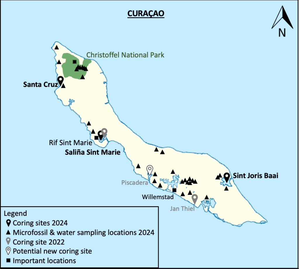
The main focus of the palaeoecological team was the coring campaign in the lagoons of Saliña Sint Marie, Sint Joris Baai and Santa Cruz (s. fig. 1).
Figure 1: Map of Curaçao showing all sampling locations from 2022 and 2024 and important locations.
Sediment cores are an important tool in palaeoecology as they can provide information about environmental changes over long periods of time through the use of palaeoproxies such as pollen and charcoal. Together with archaeological data it is possible to reconstruct the human influence on shaping the landscape. The lagoons selected for sampling (s. fig. 1) will be examined for changes in vegetation, climate and human land use associated with Indigenous, colonial and modern land use. These data will enable us to examine how human-environment interactions changed through time which can provide insights into modern conservation and management strategies. The collected cores will be dated with several techniques such as 14C radiocarbon dating (older than 200 years) and 210Pb for very recent data (the last 150-200 years). Additionally, exotic markers such as the introduction of invasive species can be used to compliment these dating methods. Furthermore, the cores will be analyzed with X-ray fluorescence (XRF) for geochemical information and a better understanding of the sedimentation processes. Pollen and charcoal analyses will be used to reconstruct past vegetation changes and fire regimes. For example, pollen grains of cultivated plants can give insights into human appearance and crop cultivation practices. Additionally, non-pollen palynomorphs (NPP) present in the pollen record can provide additional information about the environmental conditions (i.e. fungal spores can indicate the presence of herbivores). Fourier-transform infrared spectroscopy (FTIR) will be employed to analyze charcoal and infer past fire temperatures.
Preliminary Data
The first field coring campaign took place in 2022. Cores were collected from Jan Thiel (87 cm in length) and Saliña Sint Marie (155 cm in length). The radiocarbon dates from the Jan Thiel core ranged from around 710 to 910 cal BP. In contrast the Saliña Sint Marie core was dated to ca. 786 to 1059 cal BP. Due to its important location near the rock shelter, Saliña Sint Marie was again cored in 2024. Deeper sediment cores at Saliña Sint Marie are particularly important, as they could provide an insight into the period before the human occupation (ca. 5700 cal BP). The 2024 fieldwork benefitted from improved logistics following the challenges faced in 2022, including 4-foot swells caused by strong on-shore winds and the heavy weight of the coring platform. A new, lightweight platform was designed and constructed (see Fig. 2) for the expedition, consisting of a metal frame with drilled plastic planks, secured to two inflatable boats. Each day, the platform was assembled on the boats, loaded with equipment, and paddled to the first sampling location in the lagoon. To ensure stability, a modified anchor system was employed, increasing from 4 to 7 anchor points as the fieldwork progressed.
Three different coring systems — Bolivia modified Livingstone, traditional Livingstone, and Collinvaux Drop-Hammer — were used to extract cores from varying depths and sediment types. For obtaining surface cores essential for comparing historical data with the current status, the Bolivia modified Livingstone corer was ideal due to its larger diameter and transparent casing, which allows visual confirmation of an undisturbed mud-water interface (MWI). After surface sampling, deeper cores were collected using the Livingstone corer, which features a thin metal tube but lacks the strength to penetrate harder sediment layers. These cores required extrusion on the boat. Both Livingstone systems provided the advantage of allowing direct observation of core quality, assessing sediment loss, and enabling immediate lithological descriptions. However, both systems were prone to bending when encountering hard sediment and shell layers. To overcome these limitations, the robust Collinvaux Drop-Hammer system was used for deeper cores when the sediment strata became too difficult to core through. The Collinvaux utilizes non-transparent, aluminum tubes designed to withstand the force of hammering, and protect the sediments during, however visual inspection of the collected sediment is not possible in the field.
During the 2024 fieldwork, the team successfully collected one core from Saliña Sint Marie (120–273 cm in length), four cores from Sint Joris Baai (210 cm in length), and one core from Santa Cruz Lagoon (500 cm in lenght). The new Saliña Sint Marie core was dated to a basal age of 2894 cal BP, which is extending the core of 2022 by almost 2 millennia. Additionally, one continuous core of Sint Joris Baai was dated to a basal age of ca 7500 cal BP and the Santa Cruz core to a basal age of ca 850 cal BP, having several inversions.
Pollen sampling
Recent pollen samples were collected to expand the reference collection, enhancing the understanding of local plant diversity and improving the interpretation of historical core samples. This expanded reference collection will also contribute to the creation of a Caribbean pollen atlas, a key component of my PhD thesis. To prepare for sampling, species occurrences identified in core samples from Jan Thiel, as well as those documented in the literature, were compared with the existing reference collection. This comparison helped identify species not yet represented in the collection. In total, 50 new pollen specimens were collected, primarily from flowering plants, with a smaller subset obtained from the plant collection at the CARMABI Institute. Plant identifications were verified with the assistance of local expert botanist Eric Houtepen (CARMABI), ensuring the accuracy of the dataset.
Microfossil analyses
Water measurements exploring the water quality, its origin, anthropogenic influence and nutrient levels, as well as water and sediment sampling for microfossil analyses (i.e. ostracods and foraminifera) was conducted for the master thesis of Emily S. Richter (Friedrich Schiller University Jena, Germany). Ostracods and foraminifera are highly adapted microorganisms to specific environmental factors, such as salinity. Therefore, in palaeontological studies fossilized specimens can be used to reconstruct historic environmental conditions. The aim of Emily’s master’s thesis is to investigate ostracods from water bodies differing in their salinity level to establish a transfer function. This function gathers information on the salinity ranges that species in the study area inhabit, based on recent samples collected from various water bodies, such as ponds, lakes, and rivers. By using this transfer function, historical salinity levels can be reconstructed by comparing fossilized species found in sediment cores with the modern species data. To ensure the transfer function is robust and representative, it is crucial to sample at least 30 water bodies with a wide variety of salinity levels, providing a comprehensive overview of species distributions across different conditions. In addition to the transfer function, water quality measurement from surface waters and wells as a potential freshwater source and for agricultural usage was conducted. Together with the collaborators of Christoffel National Park (Quinten Rico & Roël ‘O’Him), the project was developed during the field trip, as surface water is becoming increasingly limited on the island (Rico Pers. Comm). Earthen dam systems were established and used during the Dutch colonization period, because of intense drought events and a high-water demand for agriculture and later industry. Nowadays only half of it is used and maintained. Particularly in the areas consisting of volcanic parent rock, the surface drainage benefitting from dams would lead to lower salinity, higher groundwater and well levels in the long term. (van Buurt, 2018)
During fieldwork and in cooperation with the Christoffel National Park, Hofi E’ Jardin, the Mongui Maduro Museum, the Landhuis Bloemhof and Hato Caves it was possible to collect samples in different environments along the salinity gradient across the island. These included: marine settings, lagoons, dams/fresh water reservoirs, wells and one stalactite cave. In each water body the salinity, pH, temperature, oxygen concentration, conductivity and alkalinity were measured. These parameters are mostly showing the water quality. Additionally, sediment samples were collected for the microfossil studies, which were later dyed, sieved, pre-evaluated under the microscope and dried for their transport. Thirty-two water samples along with sediment samples for analyzing the microfossils, were collected and 10 water samples for additional investigations at the Friedrich-Schiller University Jena. For the water studies, sampling was limited to selected locations due to the labor-intensive on-site preparation, which involved filtration and the addition of chemical stabilizers, as well as the potentially high analytical costs. The water origin, anthropogenic impact and nutrient levels can be identified by elemental concentrations using Inductively Coupled Plasma – Mass Spectrometry (ICP-MS) and Inductively Coupled Plasma – Optical Emission Spectrometry (ICP-OES).
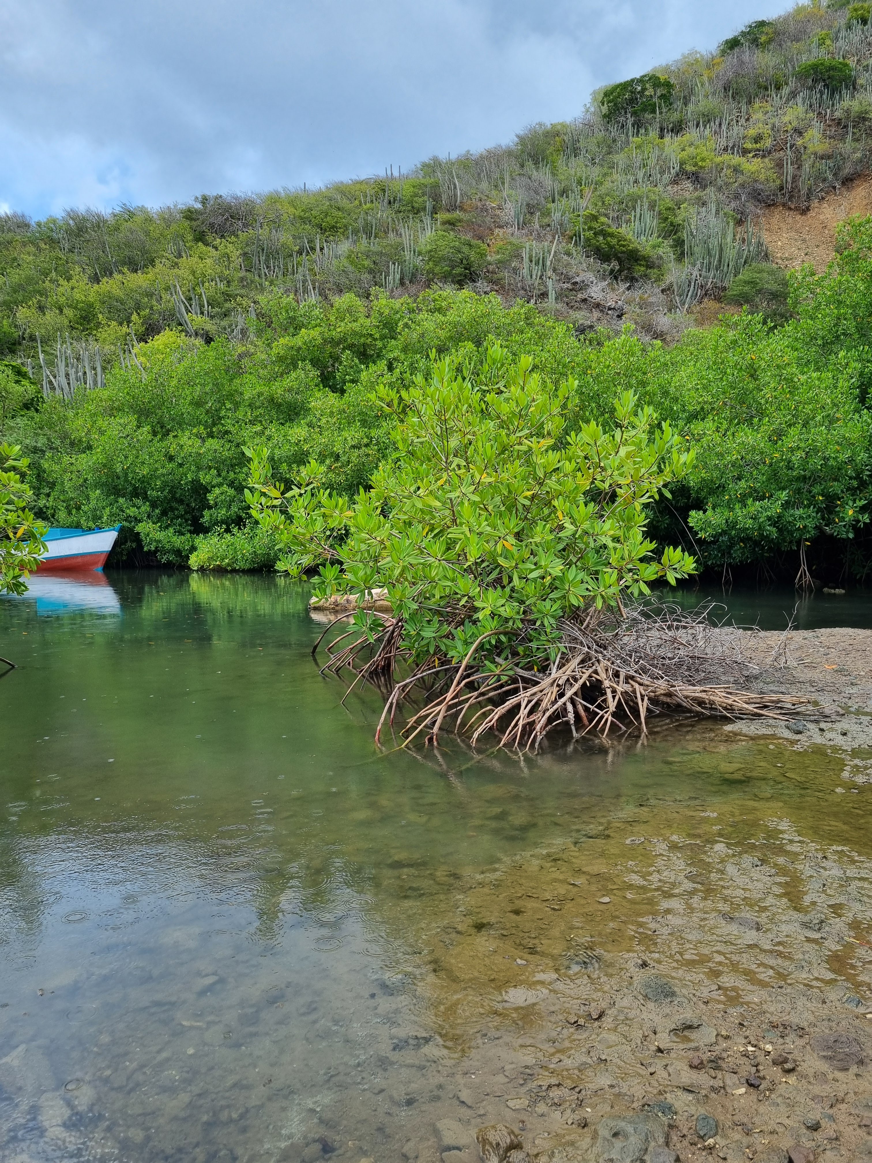
Figure 2: a) boats tied together with the platform, loaded with gear and anchors, launched into the water (left: Rebecca Lellau, Mike Ordemann, S. Yoshi Maezumi, and Emily S. Richter) b) coring with the Livingstone corer on the platform; c) the ‘mud-water interface’ (MWI) = surface core; d) red mangroves (Rhizophora mangle) recognizable by its characteristic “prop roots”; e) collecting water measurements in a marine environment conducted with two multiparameter probes (WTW) for measuring salinity, pH, temperature, oxygen concentration and conductivity; f) lowering a bucket to sample water from a well in the Christoffel National Park (with ranger Roël ‘O’Him); g) collecting water measurements at a dam system. All photos were taken by the coring team: S. Yoshi Maezumi, Mike Ordemann, Emily S. Richter and Rebecca Lellau.
After transporting all samples back to Jena (Germany) subsamples of the cores were collected for the 14C radiocarbon, 210Pb dating and XRF analyses. Currently pollen counting, identification and charcoal counting of the Saliña Sint Marie samples from 2022 is underway. The pollen reference material will be processed in the laboratory into pollen slides and will supplement our reference collection and pollen atlas. The microfossil analysis from the water and soil samples is being conducted at Friedrich-Schiller University.
Personally, this experience was an invaluable opportunity to visit the sampling locations for my PhD project, gain hands-on experience with various coring methods, connect with project members and collaborating institutes, and engage with the local community.
I want to thank the CCLP project team members and local collaborators, especially the NAAM staff, Claudia Kraan and Amy Victorina, who helped organize trip logistics and use of their facilities. I would like to thank CAMARBI, especially Eric Houtepen, for collaborating on the pollen sampling and for providing space in the institute’s drying oven. I would also like to thank all collaborators from Christoffel National Park, especially Quinten Rico & Roël ‘O’Him, Hofi E’ Jardin, Mongui Maduro Museum, Landhuis Bloemhof and Hato Caves for their assistance in water sample collection. I would also like to thank the laboratory from the Friedrich-Schiller University in the Institute of Geosciences – IGW, Applied Geology for analyzing the water samples.
A postdoctoral position in palynology and sedimentary DNA analysis, focused on understanding the environmental history of the Malagasy landscapes and populations over the last millennia, is now available working with Laurent Bremond (University of Montpellier, France). Funding is from the French National Research Agency (ANR) with support from CNRS.
INQUA fellow Alfred Hougnon continues his research into past environmental change in the Dahomey Gap (Benin). In the fourth video documenting his progress a short background to the project, and insights into field work, are given. Field work took place near the Ewe-Adakplame forest in the south east of Benin and involved the recovery of sediments using a Russian corer. The video also shows how interactions and engagement with the local community was developed during the research expedition.
To find out more above Alfreds project read posts on:
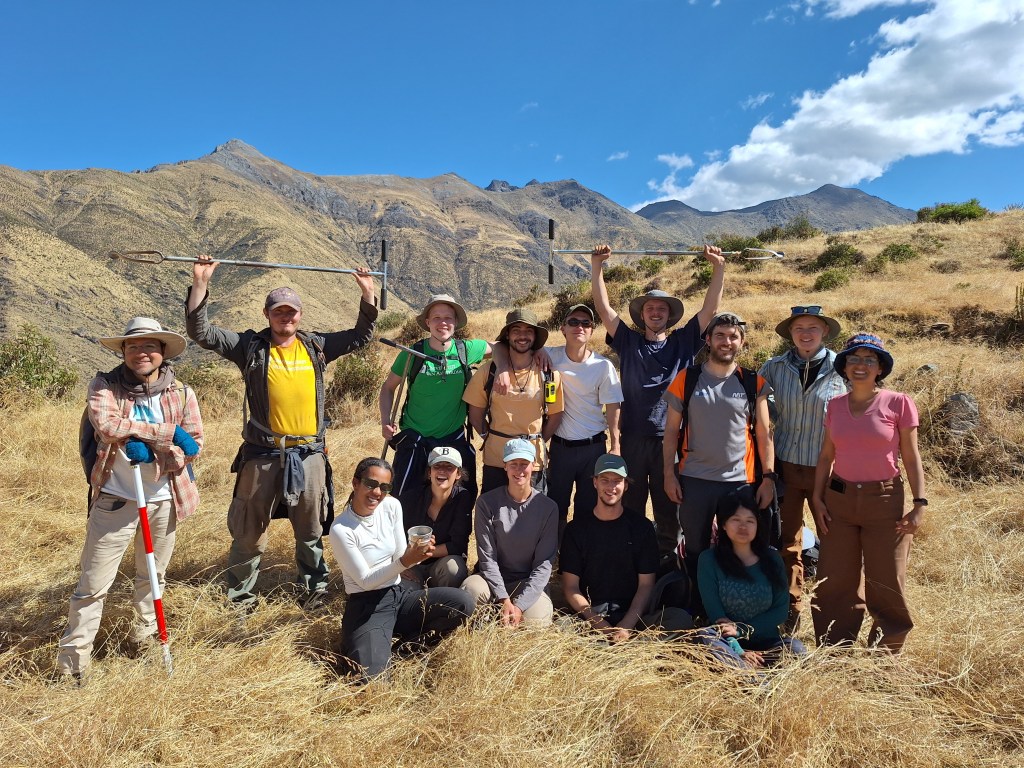
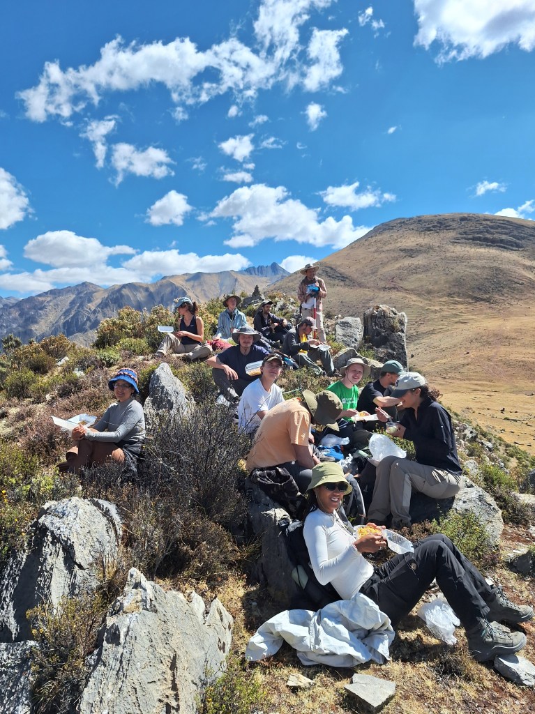
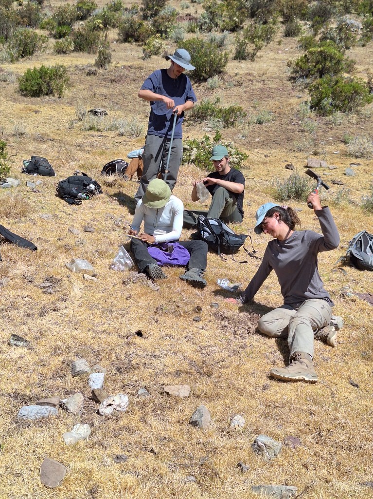
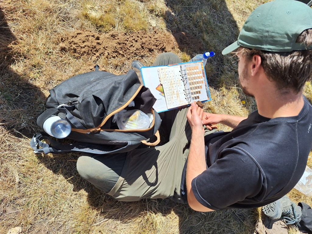
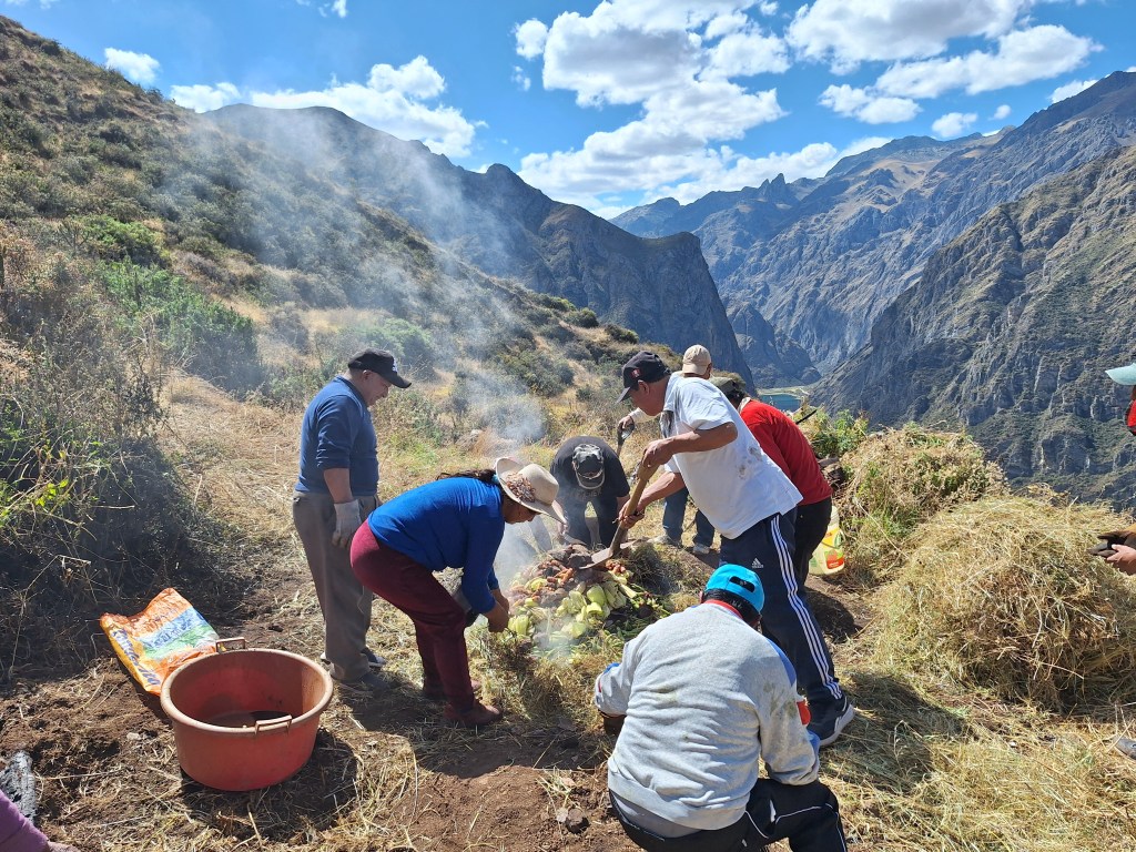
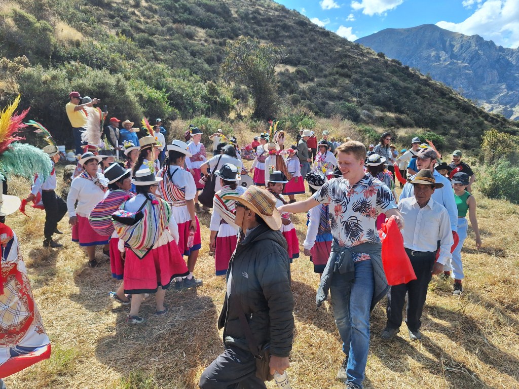
The University of Amsterdam MSc Earth Sciences “Geoecological Systems” field course took place this year in Miraflores (Peruvian Andes) during June and July. Eighteen students, including three from Peruvian institutions, spent four weeks exploring the high Andes. During this time the students developed scientific projects to address interests of the local population related to soil quality, environmental pollution, water resources and cultural heritage. Access to the area and embedding within the community was enabled by The Mountain Institute Peru. During the course the students gained extensive ‘hands on’ field experience, developed teamworking skills and discovered the benefits of a participatory approach to research.
This course runs once every two years (to find out about the 2022 expedition click here). Want to join us on a future expedition? Check out our degree program here to enroll.
Images from the University of Amsterdam Peru field course 2024
As part of my MSc Biological Sciences (University of Amsterdam) research project entitled “Assessing the effect of human induced fire regime changes on vegetation in the Drakensberg mountains” (for further details click to see previous post). I’ve travelled to Africa, where I’ll be staying a month. During this mini blogpost series I’ll take you with me on my travels!
During the first poster session, I presented my poster which went into detail on how we are developing a proxy to reconstruct past fire using micro-Fourier Transformed Infrared Spectroscopy (µFTIR). These reconstructed fire temperatures can then be compared with phytolith or pollen data to assess the effects of different fire temperatures on local vegetation over time. The presentation and poster were well received!
After my poster presentation there were two more congress days which were filled with interesting talks and beautiful posters.
de Wolf, I.K., Donders, T.H., Hoek, W.Z., Gouw-Bouman, M. & Giesecke, T. (2023) Unlocking the wealth of Dutch pollen data for future research and education. Vegetation History and Archaeobotany.DOI: 10.1007/s00334-023-00951-z
At the University of Amsterdam the MSc Earth Science is split into two tracks, one of these is entitled: “Earth System Science”. Earth System Science is a research intensive track focused on understanding the fundamentals of abiotic and biotic interactions across the globe and through time. During this degree you will spend around 6 months studying to pick up specialist knowledge and skills, and around 18 months actively developing yourself – in your key areas of interest – through project work.
The taught part of the Earth System Science track includes courses such as:
The Earth System: Learn how to analyse Earth system function across space and through time.
Analysis & Modelling Lab: Develop skills in data handeling, analysis and modeling relevant to Earth science.
Biogeochemical Cycles in the Earth System: Study how the dynamics of carbon and nitrogen link to societal challenges.
Climate Change: Explore the scientific basis for climate change an its implications for the environment and society.
Environments Through Time: Consider and analyse environmental change on timescale relevant to landscapes, societies and climates.
GIS and Remote Sensing in Ecosystem Dynamics: Learn how to use large remotely sensed datasets to gain insights into geological, geomorphological and soil systems.
Clare Lee (on one leg, left) during field course in Peru successfully published her literature review which she conducted as part of her MSc in Earth Sciences at the University of Amsterdam.
In addition, free elective courses are possible from across the University of Amsterdam, or at other approved organizations or universities, i.e. it is possible to pick up skills in other specialisms (for example in languages, AI, or programming), or study a course at a university abroad, and have this included within your University of Amsterdam MSc Earth Science degree.
The project part of the Earth System Science track includes two research projects, or one research project and one internship with an external organization (such as a company or NGO). MSc research projects are often closely linked to active research within the Institute for Biodiversity & Ecosystem Dynamics. Some projects and literature reviews conducted by our MSc researchers reach a high enough level to be published in international scientific journals, either on there own or as part of a wider collaboration. Examples of recent papers including MSc researchers (highlighted in bold) are:
Lee, C.M., van Geel, B. & Gosling, W.D. (2022) On the use of spores of coprophilous fungi preserved in sediments to indicate past herbivore presence. Quaternary5, 30. DOI: 10.3390/quat5030030
de Nijs, E.A. & Cammeraat, E.L. (2020) The stability and fate of Soil Organic Carbon during the transport phase of soil erosion. Earth-Science Reviews 201, 103067. DOI: 10.1016/j.earscirev.2019.103067
Interested in African paleoecology? Want to incorporate African pollen data into your research or teaching?
The African Pollen Database (APD) has been updated, and the Neotoma Paleoecology Database now contains over 200 APD records. Many community members filled out a recent survey to help us format of our meetings in order to start focusing on helping people use APD data for research and teaching!
This Wednesday, February 8 at 9am EST, we will announce our finalized schedule for the next few months during a short meeting and provide a short (10 minute) walkthrough of the African Pollen Database on the Neotoma Paleoecology Database. Join us live for this short meeting at 9am EST time or check out the recording afterwards, which we will post here.